High Coast/Höga kusten, Skuleberget, Nämforsen
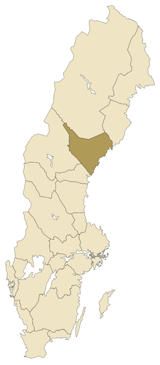
Ångermanland is located in Norrland (central-eastern Sweden), being with its ca 19 800 km² (5% of the whole country) the sixth biggest province of all 25. The province includes 3 counties and it belongs to the dioceses of Härnösand and Luleå. It has a population of ca 131 500 inhabitants (17th place of 25), thus having a density of only 6,5 inhabitants/km².
The highest point is Tåsjöberget in Strömsunds kommun (northwestern Ångermanland) with 635 m. The biggest lake is Tåsjön (ca 45 km², altitude of 252 m), located in the northwest of the province. The plant symbol of the province is the heart’s ease (styvmorsviolen) and the animal symbol is the beaver (bävern). Other symbols: the grey-headed woodpecker bird (gråspetten), the freshwater whitefish (sik), the insect the giant woodwasp (stora hornstekeln), the apple sort Kramfors, the fungus the crab brittlegill (sillkremlan), the tät fransmossa moss, the rock type Nordingrå granite/granit and the element of carbon (kol/C).
Source: https://upload.wikimedia.org/wikipedia/commons/3/3d/%C3%85ngermanland.svg
Source: https://upload.wikimedia.org/wikipedia/commons/4/4d/%C3%85ngermanland_landskapsvapen_-_Riksarkivet_Sverige.png
Ångermanland consists of three counties (län):Västernorrland, Jämtland and Västerbotten, Västernorrland being the largest of the three. Ångermanland has 9 municipalities, X registration districts and X urban areas. The biggest city in Ångermanland is Örnsköldsvik with ca 33 350 inhabitants. Prince Nicolas (b. 2015) is duke of Ångermanland.
Here you can find information from every municipality in Ångermanland. Click on the name in order to go further and read more about places to visit and things to do in Ångermanland.
Följ min blogg
Få nytt innehåll direkt till din inkorg.
